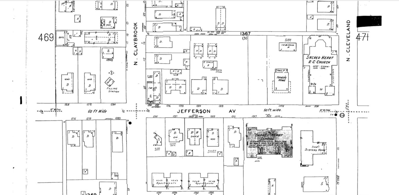
A good friend sent me a copy of the 1953 Sanborn Map with my house on it.
Even though it’s basically a crude line drawing it brings back a lot of memories.
I was raised at 1296 Jefferson, in a duplex just east of Claybrook. You can see the house just about the middle of the image. The skinny but deep house just to our west has some interesting stories, one of which I’ve posted before. It’s interesting that the two little sheds that we had behind our house, one for us, and one for our neighbors (we owned the duplex) are represented. Such a small thing that shows the detail of the drawing.
I learned to ride my bike from my house to the parking lot of the Sacred Heart Church and back. The Father’s house just to it’s west wasn’t there back then. I cut that corner to sharply one day and went over the handlebars headfirst. Scraped up pretty badly but it was a lesson I learned quickly, and only once. I’ll post more memories of this special (to me) place soon.